
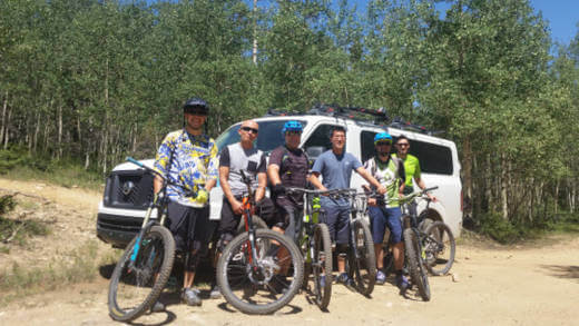
South Boundary Trail Shuttle
The South Boundary Trail is consistently ranked the best trail in New Mexico and the southwest. We’re not bragging, we’re just emphasizing why you should book your shuttle early! Fortunately, we’ve made it ridiculously easy, to start your adventure.
How to Book
Step 1
Choose your drop-off location
FR76 is what you really want. With the NEW DROP location it’s just 0.9-miles and 200 ft of climbing to Osha Pass and the legendary South Boundary Trail descent.
If you’re dead set on Garcia Park, which cuts off 7 miles (including the famed “Heaven on Earth” descent, we can do that too.
Step 2
Choose the date
We run daily mountain bike shuttles to the South Boundary Trail from as soon as the snow melts until the end of October — snow permitting.
(Note: If your dream date shows no availability online, please email us at ride@shuttletaos.com for options.)
Step 3
Reserve and be happy
You’ll receive a confirmation email explaining where to meet and tips for the ride. If you have any questions, contact us and we’ll get you sorted.
Note: If a date is currently unavailable online, that means we are either booked for a special event or the shuttle is full. However, there may be options. Contact us to explore how to make sure you get the adventure you deserve.
9:00 am – FULL SBT from FR76
9:00 am shuttle to Forest Road 76 for the FULL South Boundary Trail and the 20-mile IMBA Epic ride to your car.
We also offer a 12:00 noon shuttle for groups of 4 or more.
$45 per person
Book Now!
12 noon – Garcia Park
* Groups of 4 or more. *
Given the new higher drop point on FR76, most folks now prefer that route.
However, we’re happy to shuttle you by request.
$45 per person
Learn MorePlease consult our cancellation and solo-passenger policies before booking.
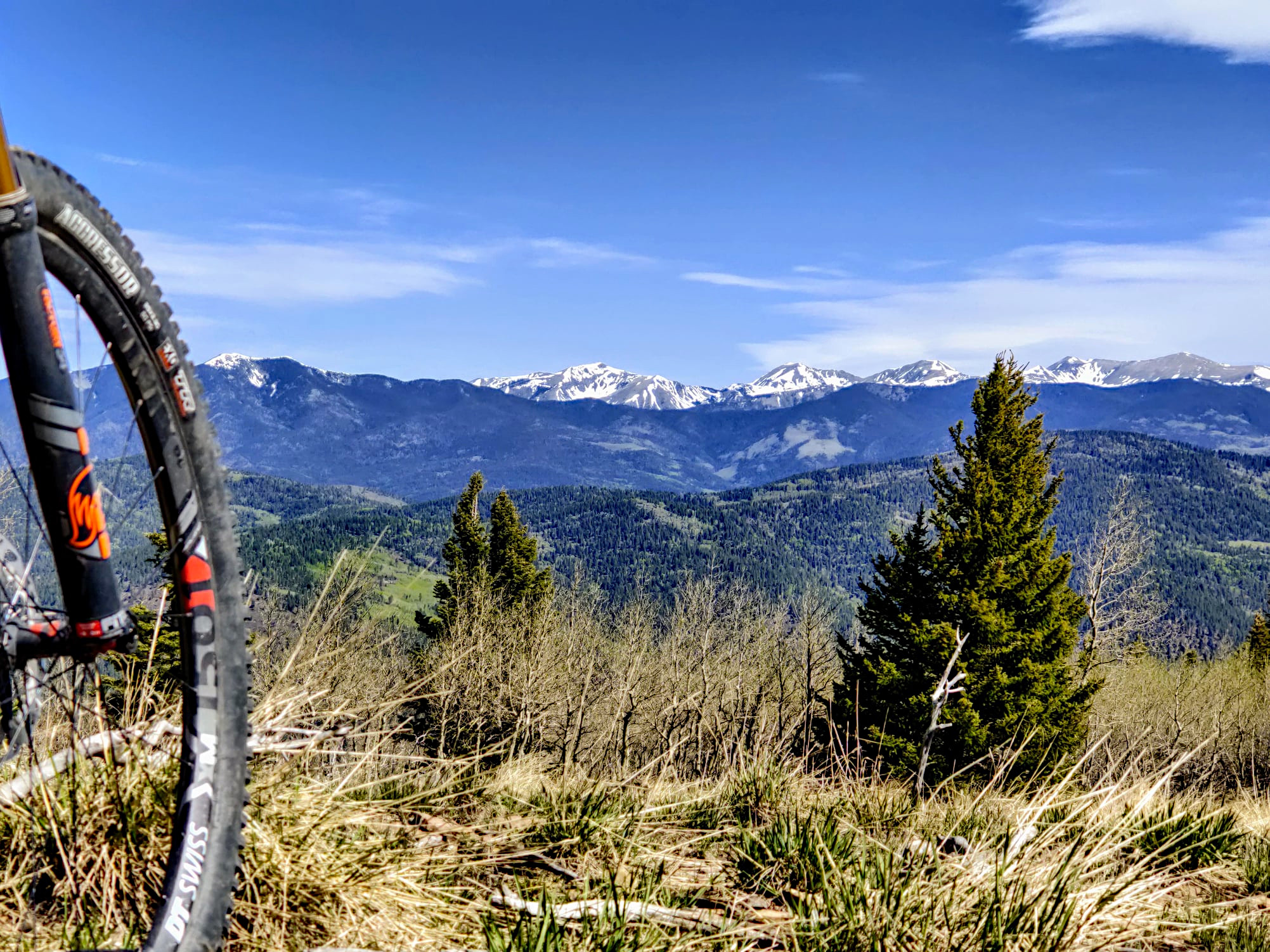
About The South Boundary Trail
The “IMBA Epic” South Boundary Trail begins at 10,525 ft of elevation off Forest Road 76 near Angel Fire and ends at the El Nogal Trailhead just east of Taos at a little over 7,000 ft. Throughout its delicious 20 miles of high alpine meadows and cool mixed-conifer forests, you’ll climb 1,150 ft and descend a giggle-worthy 4,500 ft along classic side-hill single-track, occasional abandoned two-track, and a few fall-line descents to keep it all interesting.

Osha Pass and Heaven on Earth
The highest point on the ride is Osha Pass at 10,710 ft. You get there via a challenging 1.5 mile, 800 ft climb mellow 1 mile, 200 ft climb from the start thanks to the new upper trailhead. Gone are the days of riding loose rocks walking up hills, the start is now an easy jaunt that will wake up your legs after the shuttle.
From Osha Pass, it’s a ripping descent through Corner Park and the appropriately named “Heaven on Earth” section. Just beyond is a gentle climb to Garcia Park which is accessed by Forest Road 437 (and our second shuttle drop-off point).
Garcia Park Down
From Garcia Park, you climb another ~400 ft (slightly more if you take the Sierra Don Fernando spur — which you should) before you start the long traverse/descent that rides downhill both ways. At Cross-over Meadow, scrub oak indicates you’re about to begin the balance of the descent through several eco-zones, including ponderosa and pinyon-juniper forests.
El Nogal
Along the last 3.5 miles, the character of the trail changes considerably, and the technical requirements increase. This is the famed “El Nogal” descent. If you have handled everything up to the obvious log drop at the intersection with the Ojitos Trail, you should be fine. However, if you’re struggling, you may consider taking the Ojitos Trail off the ridge-line instead.
Please note: from the log drop down, the trail is used heavily by hikers, dog-walkers, equestrians, and others. Please check your speed and ride courteously.
Take a Map!
To keep on track, you’ll want to have Trailforks or MTBProject loaded on your phone.
Get 30% off a Trailforks Pro subscription by supporting the Enchanted Circle Trails Association who creates, maintains, and promotes our area trails for everyone’s benefit.
South Boundary Upper Shuttle on Trailforks.comFrequently Asked Questions
We run shuttles from snow-melt to snow-fall. Volunteer crews usually have the trees cut by mid-June, and the high country ride through the trees is great for beating the heat through July and August. From mid-September through mid-October, the aspen leaves are positively popping.
Not at all! We shuttle backpackers, trail runners, through-hikers, and dog walkers.
Most of the South Boundary Trail is a solid blue trail with some challenging sections interspersed. The last 3 miles (known as the El Nogal Section) are a consistent black rating, with loose rocks, steep drops, step-downs and sharks teeth. That being said, there is no mandatory air, and the tricky sections are all walkable.
For most mountain bikers, the average ride time from FR76 ranges from 3-5 hours. But experiences vary WIDELY.
The fastest known time is 1:33 held by local pro racing legend Macky Franklin — we don’t recommend that approach.
Don’t be ashamed if it takes you upwards of 6+ hours. Pack your lunch, wipe off your camera lenses, and stop to enjoy the wildflowers.
This is a cross-country single-track trail interspersed with a few double-track roads. Most of the descent is in the final 2.5 miles of the trail which is straight-up downhill style riding.
We recommend a cross-country bike, trail bike, or enduro bike. However, we also take plenty of downhill bikes thanks to folks visiting Angel Fire Bike Park whose wrists need a breather from the downhill beater.
While the trail does criss-cross some two-track, and at times you may be tempted by another route, it is fairly burned in and should be obvious. An app like Trailforks or MTBProject will help keep you on track if you have questions. There are also markers every mile, so if you don’t see one of those for a while, you’ll know you’re off course.
No. Sorry, but the latest National Forest policy does not allow the use of e-bikes on non-motorized trails.
Yes! The timing works well for those who want to split their group. More ambitious riders can take the early shuttle and ride to meet the second wave at Garcia Park coming up on the later shuttle.
The South Boundary Trail loses most of its elevation in the last 5 miles, with the steepest of those being the last 3 miles called the “El Nogal” section.
For those less experienced riders — or if you’ve had any trouble with what you rode up to the “log drop” at the Ojitos trail — we recommend taking the Ojitos descent instead of the El Nogal technical downhill descent. Ask your shuttle driver for details.
All shuttles pick up at the El Nogal Trailhead, aka, the end of the South Boundary Trail on Highway 64, three miles east of Taos in the Taos Canyon. It’s a darn busy lot on weekends so we strongly recommend carpooling. Half of the lot ends up with shade and the other scorching with the sun. But, either way, please do not leave your pups in the car while you ride.
No. Campers can go up the canyon a quarter mile to two small USFS campgrounds between the road and the river. There are usually vacant lots unless it’s a holiday. You can ride from these campgrounds to El Nogal along the nearly non-existent shoulder – just a skip and a jump. But please be careful, the canyon is tight.
There is no potable water on the trail. Cell service is spotty at best (Verizon is most consistent, but still bad). There are few bail-out trails, but each is long and steep back to the highway. In short, you should be self-sufficient, and able to handle almost any emergency / technical situation.
Having never ridden with you, your partner, or your kid, that’s impossible for us to answer as we don’t know your skill level, route-finding skills, or even general level of confidence in the back-country. The South Boundary Trail is a remote trail, generally considered intermediate with some expert sections (all of which you can walk around).
Our friends at Heritage Inspirations have an excellent e-bike tour of Taos that takes in a bit of the culture, history and landscape of the area: https://www.heritageinspirations.com/taos-ebike-tour
South boundary Shuttle Booking Policies
- Reservations must be made 12 hours before departure time — but the sooner you book, the more likely we’ll have room.
- Full payment is required at time of booking.
- Price does not include driver gratuity.
Cancellations
- Cancellations up to 48 hours before the trip will be refunded less a 20% processing fee.
- No refunds are given for cancellations within 48 hours of the departure time, including on seats booked with vouchers or passes.
- No shows … c’mon, give us a heads up so the whole shuttle isn’t waiting for you to show up at the parking lot!
Solo Passenger
- We charge an additional $30 if you are the only passenger on the shuttle. However, we will make every effort to encourage others to join you, and will not charge this fee until we have communicated your options with you directly.
Sorry, No E-bikes
- Sorry, but no e-bikes are allowed on non-motorized trails on the Carson National Forest. This includes the South Boundary Trail. Please see the latest policy decision.